


SXblue Platinum GNSS Receiver for GIS, Surveying, Mapping
Please contact us to Purchase,
or for a Quotation, or Demonstration.
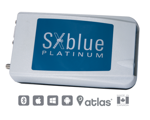
SXblue Platinum
The SXblue Platinum is a GNSS receiver supporting all current and future constellations with triple frequency and offering the ability touse a global coverage of satellite corrections.
The SXblue Platinum is a compact, lightweight, palm-size GNSS receiver that provides real-time professional-grade positioning information.
With the scalable SXblue Platinum Basic, you can activate any frequency or constellation at anytime after your initial purchase. The receiver is also field upgradable which means that you can activate any option remotely at your convenience.
Atlas delivers its correction signals via L-band or it can stream data over the internet (NTRIP) at accuracies ranging from meter to sub-decimeters levels assuring the best available vertical and horizontal accuracy.
With a wide variety of compatible software and mobile devices, our team can help you choose the perfect solution for your applications such has agriculture, engineering, mining, utilities, surveying, GIS and many others.
Some of the many compatible softwares are:
ESRI Collector, ArcPad, Fulcrum, TerraGo Edge, and MicroSurvey FieldGenius and many others.
iSXBlue RTN, a free iOS application for NTRIP/DIP configuration, is available on the App Store.
- GPS, GLONASS, Galileo, BeiDou, QZSS and SBAS
- Triple-frequency L1-L2-L5.
- Bluetooth connectivity. Compatible with all devices
- 1 cm RTK accuracy, long-range RTK baseline with fast acquisition times.
- aRTK™ and Tracer™ provide positioning sustainability if the GSM fails.
- Atlas™ Global satellite correction service.
Receiver |
|
| Type | GNSS triple-frequency RTK with carrier phase |
| Signal |
GPS – L1CA, L1P, L1C, L2P, L2C, L5 GLONASS – G1, G2, P1, P2 BeiDou – B1, B2 Galileo – E1BC, E5a, E5b QZSS – L1CA, L2C, L5, L1C |
| Channels | 394 |
| SBAS |
3 satellites parallel tracking WAAS/EGNOS/MSAS/GAGAN |
| RTK Accuracy | 8 mm + 1 ppm (RMS) Horizontal |
| SBAS Accuracy | < 30 cm HRMS1 |
| Autonomous Accuracy | 1.2 m HRMS1 |
| Cold start | < 60 sec (typical no almanac or RTC) |
| Reacquisition | < 1 sec |
| Max speed | 1850 kph (999 knots) |
| Max altitude | 18 288 m (60 000 ft) |
| Differential options | SBAS Autonomous, External RTCM, RTK, L-Band (Atlas) DGPS |
Power |
|
| Battery type |
Field replaceable, rechargeable Lithium-Ion pack (Rechargeable inside unit or separately) |
| Battery life | 10+ hours3 |
| Charging time | 4-5 hours using supplied charger |
Environmental |
|
| Operating Temperature | -40°C à +85°C (-40°F à +185°F) |
| Storage Temperature | -40°C à +85°C (-40°F à +185°F) |
| Humidity | 95 % non-condensing |
| Compliance | FCC, CE, RoHS and Lead-free |
Communication |
|
| Ports | Bluetooth 2.0, RS-232C, USB 2.0 |
| Bluetooth | Class 1 (Typical range of 250 m)2 |
| Baud rates | 4800 – 115200 |
| Data I/O formats | NMEA 0183, Binary |
| Timing Output | Free option, available on request |
| Event Marker Input | Free option, available on request |
| Raw Measurement Data | Binary (Free RINEX utility) |
| Correction I/O Protocol | RTCM 2.3, RTCM 3.2, CMR, CMR+, ROX Format |
| LED mode indicators | Power, GNSS lock, DGPS position, DIFF lock, Bluetooth connection |
| LED battery indicators | 5 LED |
Mechanical |
|
| Enclosure material | Re-enforced Nylon |
| Enclosure rating | Waterproof, dustproof, IP65 |
| Battery case material | ABS |
| Dimensions | 14.1 cm x 8.0 cm x 4.7 cm (5.57” x 3.15” x 1.85”) |
| Weight | 481 g (1.06 lbs) |
| Data Connectors | DB-9 female, USB Type B female |
| Antenna connector | SMA female |
GNSS Antenna |
|
| GNSS Freq Range | L-Band, GPS L1 : 1.525 – 1.610 MHz; GPS L2 : 1.217 – 1.260 MHz |
| Impedance | 50 Ohms |
| Gain | 28 dB ± 2 dB |
| Noise Figure | 2.5 dB |
| Voltage/Current | +4.5 à +5.5 Vcc |
| Connector | SMA female |
| Dimensions (H x D) | 26.6 mm x 66.3 mm (0.86 in x 2.6 in) |
| Weight | 125 g (0.363 lb) |
| Temperature | -55°C à +70°C (-67°F à +158°F) |
| Humidity | Waterproof |
We Also Recommend