


SXBlue II + GPS Satellite Receiver for GIS
Please contact us to Purchase,
or for a Quotation, or Demonstration.
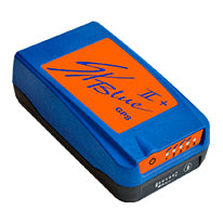
SXBlue II + GPS
The SXBlue II + GPS is a compact, real-time receiver that delivers true sub-meter performance every second to your application. Its integrated lightweight design makes it the ideal choice for a variety of industry applications including GIS, Forestry, Mining, Utilities, Agriculture, Survey and Environmental, at a price you can afford.
Go Real-time, All the Time!
The SXBlue II + GPS uses innovative technology that delivers sub-meter accuracy in real-time, all the time. There is no need for post-processing or a beacon receiver when WAAS, EGNOS, MSAS, or GAGAN are available. Even in forestry applications and other difficult mapping environments where GPS reception is limited, the SXBlue II is designed to keep working and deliver the DGPS accuracy you need all day long.
Accuracy and Productivity in One
The SXBlue II + GPS takes real-time accuracy a step further. Its accurate code phase measurements and leading edge multipath mitigation delivers sub-60 cm (2dRMS, 95% confidence) positioning. With its superior tracking performance and innovative real-time positioning, that means no downtime even in harshest conditions, the SXBlue II maximizes your productivity by working directly within your GIS framework (ESRI, Autodesk, CMT, Integraph, MapInfo, TDS, etc.) both in the field and the office.
A Long Term Solution
Add a field computer that suits your application, an off-the-shelf software of your choice, and the SXBlue II + GPS becomes the heart of a modular solution you can gr ow with. In today’s rapidly evolving technologies, its unique multi-port interface (fully independent Bluetooth, USB, RS-232 ports) helps to protect your long term investment by always allowing the use of up-todate computer hardware, operating system and software.
Options
The SXBlue II + GPS can also evolve with your needs with its optional features:
- 10Hz or 20Hz output rates
- Base Station (standard RTCM-104 output)
- Proprietary RTCM for sub-30cm accuracy
- Single Frequency Real-time Kinematic (RTK) for cm level accuracy
- Carrier Phase for post-processed cm level accuracy
Key Features
- Sub-60cm, 2dRMS real-time performance
- Multi-port interface (Bluetooth, USB, RS-232)
- Rugged and Waterproof design
- Integrated Li-Ion battery pack for 10+ hours autonomy
- Battery fuel gauge
- Compact and lightweight
- RoHS compliant
We Also Recommend